Fire Season in Mammoth Lakes
What Those Slash Piles and Helicopter Water Drops Really Mean for Our Community

As a longtime Mammoth Lakes real estate broker and owner of Matthew Lehman Real Estate, I spend my days helping people find their dream mountain homes. But every summer and fall, conversations with clients inevitably turn to wildfire safety. If you’ve been out on the trails or driving around the basin lately, you’ve probably noticed crews thinning trees, stumps dotting the landscape, slash piles stacked high, and helicopters dipping into lakes for water. It can look alarming, like the forest is being “cut down.” I want to share some straight talk on what’s happening, why it matters, and how it makes our corner of the High Sierra safer.
Fire Season Reality in the High Sierra
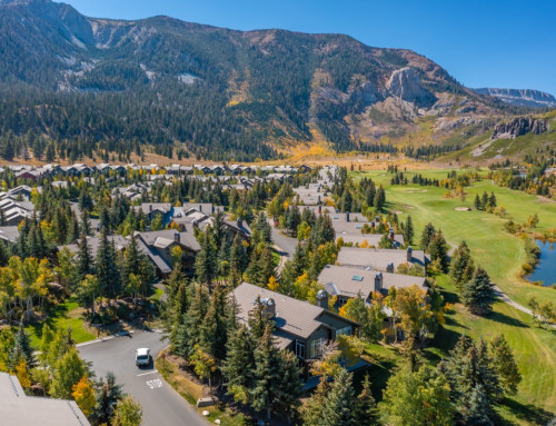
Mammoth Lakes sits squarely in the Wildland-Urban Interface (WUI), where homes meet dense forest. Fire season here is no joke. Dry conditions, lightning, and human activity can spark fires, while strong winds, especially from the west, can drive them rapidly toward town. Fuels reduction work is ramping up across the Inyo National Forest and local areas through projects like the Eastern Sierra Climate & Communities Resilience Project (ESCCRP). You’ll see this activity intensify from spring through fall.
Those helicopters scooping water from lakes (like Mary Lake or others) are often training or supporting initial attack capabilities. They’re a visible reminder that agencies stay ready. Air support can make all the difference in keeping small incidents from becoming major ones.
 Understanding Slash Piles and Forest Thinning
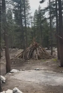
Slash piles like those near Lake Mary or Coldwater Campground are those stacks of branches, twigs, small trees, and woody debris you see. They come from fuels reduction and forest health thinning projects. Crews (hand crews with chainsaws or mechanical equipment) remove understory brush, ladder fuels (small trees and branches that let fire climb into the canopy), dead or dying trees, and overcrowded growth.
Why so much cutting? Decades of fire suppression created overly dense forests. Too many trees compete for water, light, and nutrients, leaving them stressed and vulnerable to drought, bark beetles, and intense wildfires. Thinning mimics historic, healthier forest conditions, fewer, stronger trees with more space.
The material that can’t be removed or chipped gets piled into slash piles for controlled burning in fall and winter, when snow and moisture make it safe. This is far better than leaving fuels on the ground, where they could feed a wildfire.
The Role of Bark Beetles in Forest Decline
Bark beetles, particularly the mountain pine beetle, have played a major role in the death of many trees across the High Sierra, including areas around Mammoth Lakes. These native insects are always present in small numbers, but drought-stressed and overcrowded trees have far weaker defenses. Beetles bore into the bark, disrupt the tree’s nutrient flow, and introduce fungi that further weaken or kill the host.
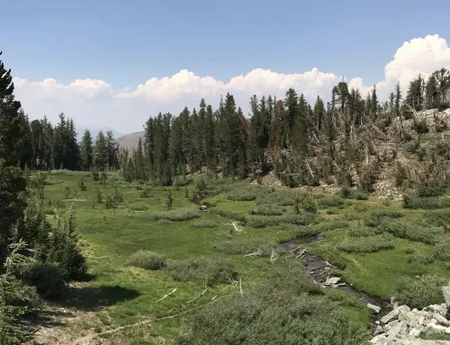
In recent years, significant mortality has been documented in lodgepole, whitebark, limber, and western white pines near Mammoth. Overcrowding from fire suppression combined with prolonged drought has fueled outbreaks, leaving behind large numbers of dead and dying trees that add to wildfire fuels if not addressed. Thinning projects often target these hazard trees to reduce risk and help remaining healthy trees thrive.
Building Protective Barriers, Especially on the Western Edges 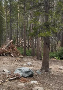
A key focus in Mammoth is creating fuel breaks and reduced-fuel zones, particularly on the western and southwestern approaches. Prevailing winds often blow from the west, pushing fires toward town from that direction. Thinning in these strategic corridors (along roads, near communities, and key drainages) slows fire spread, lowers intensity, and gives firefighters a better chance to defend homes and infrastructure.
Projects target areas like Shady Rest, Earthquake Dome, Reds Meadow, and zones near Highways 203 and the Scenic Loop. The goal isn’t to clear-cut but to restore resilience, protecting our drinking water, recreation areas, wildlife habitat, and property values.
This work is proactive and science-backed. It reduces the chance of high-severity fires that could devastate large swaths of forest and nearby homes.
What This Means for Homeowners and Buyers
If you own or are considering property in Mammoth Lakes:
- Defensible space is your first line of defense (Zones 1 and 2: 0–30 ft and 30–100 ft from structures).
- Thinned areas near developments often enhance safety and appeal.
- Properties with good fuels management hold value better in today’s market.
I always advise clients to check with the Mammoth Lakes Fire Protection District, review CWPP (Community Wildfire Protection Plan) maps, and consider hardening features like ember-resistant vents and roofs.
 Looking Ahead with Optimism
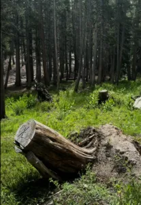
Seeing slash piles and water-dropping helicopters can feel unsettling, but they signal investment in our community’s future. These efforts, by the USFS, CalFire, Mammoth Lakes Fire Protection District, Whitebark Institute, and partners, help ensure the High Sierra remains a vibrant place to live, visit, and invest for generations.
If you’re thinking about buying, selling, or need help navigating local resources for defensible space or property prep, reach out.
At Matthew Lehman Real Estate, we know this market and this landscape intimately. Let’s keep Mammoth strong. Love Fully Now, stay informed, and enjoy the mountains responsibly.
What are your experiences with these projects? Feel free to comment below or contact me directly. Stay safe out there!
Full Video on You Tube: https://youtube.com/shorts/CR7ttUkd_tw?feature=share
You may also like:
One of My Favorite Hikes in Mammoth Lakes: Coldwater Trailhead to Duck Lake – Mammoth Lakes CA Homes for Sale – Matthew Lehman Real Estate
Mammoth Lakes Real Estate Market Report July 2026
Events Happening in Mammoth Lakes | Visit Mammoth